More Coverage


Twitter Coverage
JOIN SATYAAGRAH SOCIAL MEDIA


"The formidable power of geography determines the character and performance of a people": Fascinating map of all the places of ancient India as mentioned in Mahabharata, put on display in Purana Qila, which is the ancient Indraprastha of Mahabharata

Bharata Khandais a term used in Hindu texts, including the Vedas, Mahabharata, Ramayana, and the Puranic, to describe the Indian subcontinent. The historical context of the Sanskrit epics are the Vedic period (c. 1700–600 BCE), Mahajanapadas (c. 600s BCE), and the subsequent formation of the Maurya Empire (c. 300s BCE) and Gupta Empire (c. 300s CE) also with the beginning of the "golden age" of Classical Sanskrit literature.
In Hindu scriptures, Bharata Khanda is the habitable world; the known land as experienced by the writers. It is named after the legendary emperor Bharata and was first used in the Early Vedic Period (c. 1750–1100 BCE)
Here is a fascinating map of all the places of ancient India as mentioned in Mahabharata. This map is put on display in Purana Qila, which is the ancient Indraprastha of Mahabharata.
|
Take a look at the map and see the name of your region during those days.
Mahabharata is simply the encyclopedia of ancient India. The geographical details are very comprehensive.
To the NW in Afghanistan is country of Yavanas, the Bactrian Indo-Greeks (Modern Begram). To their East in Hindukush is the country of Aśvakas and Kāmbojas. The Kamviri Nuristanis of Afghanistan, Kamboj of Punjab and Kammas of Andhra Pradesh could be their partial descendants.
To their immediate east are the Cīnās, Lāḍakas (Ladakh) and Rāmaṭhas(Bhotas). These were Tibetan people . Chinese were known as Mahācīnās.
To the south of Kāmbojas is the country of Gāndhāra with its capital at Takshashila (Taxila). This is the Attock-Swat-Charsadda-Peshawar-Islamabad region. To the south of Gāndhāra is the kingdom of Kekaya, which is the modern Dera Ismail Khan region between Jhelum and Indus.
To their south is the kingdom of Sibi and its capital Sibipura(which is the modern Sehwan).
To their east in the modern Majha region of Punjab is the ancient kingdom of Madrā. To their east is Vāhikas on the other side of the river Iravati(Ravi).
Bahlikas is misplaced in this map and they should really belong to Balkh, Afghanistan.
To the North of Vāhikas is the kingdom of Trigarta with its capital at Sakala(Sialkot). This is the Jammu-Sialkot region.
To their north is the kingdom of Kashmir (Kaśmīra) with its capital at Rājapura (Rajouri). Remember that Shrinagara (Srinagar) was established by Ashoka who post dates Mahābhārata. As such, it does not appear in this map
To the North of Kashmir is the kingdom of Daradas (dards of Gilgit-Chitral-Yasin).
To the east of Trigarta is the kingdom of “Audumbaras” which is the ancient kingdom of Himachal. To their east is the kingdom of “Khasas” which are the Nepali people speaking “Khas kura”.
Interestingly, Malavas and Yaudheyas still inherit the Indus-Satluj region in the Mahābhārata. In the post-Mahābhārata age, Malavas win over lands from east Punjab to Madhya Pradesh.
Malwa of East Punjab (Ludhiana) and Malwa of Madhya Pradesh is still named after this tribe.
Yaudheyas also moved east and conquered the Haryana region. They established their capital at Rohitaka (Rohtak). To the south of Punjab are ‘Sauviras’, who are the modern ‘Saraiki’ speakers of Sindh-Multan.
To their east is the kingdom of Kuru, the modern Haryana region around Delhi. It had two capitals- Indraprastha (Delhi) and Hastinapura (Meerut). To their South-East is the kingdom of Panchalas. It also had two capitals. “Ahicchatra” in the north and “Kampilya” in the south.
According to Mahābhārata, Ahicchatra was ruled by Drona’s son Ashvatthama.
As Guru Dakshina, Arjuna brought before Drona the King Drupada as a captive. Drupada then gave the state of Ahicchatra to Droṇa and got his release. (Mahābhārata, Ādi Parva, Ślokas 73 to 76, Chapter 137).
To the west of Panchalas is the kingdom of “Yadus” with its capital at Mathura. To their south is the kingdom of “Kuntala” (Gwalior) and “Nishada” (Bundelkhand). The west of Mathura was conquered by other Yadu tribes like ‘Andhakas” and ‘Surasenas.
The Matysa kingdom belonged to the Jaipur region with its capital at Viratanagara (modern Bairat).
Vatsa was the ancient kingdom of the Prayaga region with its capital at ‘Kaushambi’. “Magadha” is the modern Patna region with its capital at Girivraja (Rajgir).
North Bihar (Mithila) region was inhabited by ‘Videhas’ with their capital at ‘Mithila’. Vrijis had their capital at Sravasti (Balrampur). To their west was the kingdom of Kosalas with its capital at Ayodhya.
To the west of Andhra was the kingdom of ‘Kuntala’ which is the modern-day “Uttara Kannada” and South Maharastra region. To the North-West of Kuntala was Goa which was then known as Aparanta. To the South of Kuntala is the kingdom of Karnata which is the Bangalore region.
To the South of Karnata, are the three countries of Tamilakam. The country of Dravidas & their capital of Kanchi. The country of Pandyas & their capital Madura(Madurai) in the extreme South. The country of Cholas on the banks of Kaveri.The country of Keralas in the Malabar coast.
In the Karna Parva(12.15) of Mahabharata, all three kingdoms: Pandyas, Keralas, and Cholas are clubbed as “Dravidas”.
Described as tall and broad-chested warriors with courage like that of a ruttish elephant.
Dravida= entire region comprising today’s Tamilnadu and Kerala.
In the Mahabharata War, the Pandya king fought on the side of the Pandavas. He slaughtered the armies of Duryodhana.
He slaughtered the Bahlikas, Khasas, Kuntalas. His bravery was praised in Mahabharata. In the end, he was killed by the Drona’s valiant son Aśvatthāmā.
The city of Gokarna in the South Konkana region was already famous in Mahabharata (3.275 vulgates) as “the favorite resort of Lord Shiva”.
Agastya’s hermitage existed to the south of it. And it was here that Vatapi was “digested” by Agastya according to Puranic lore.
Central India roughly corresponding to the Malwa region and western Madhya Pradesh was the country of “Avanti”.
Ujjayani (Ujjain) was the capital of Northern Avanti and Mahishmati on the banks of ‘Narmada’ was the capital of Southern Avanti.
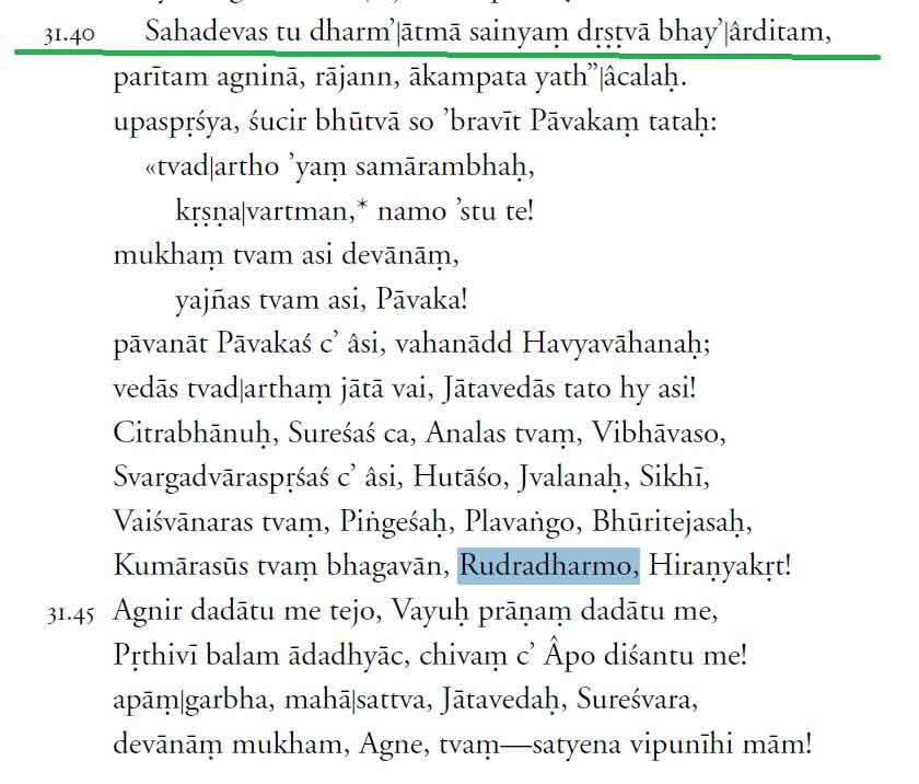
According to Mahabharata, Mahishmati had a formidable fortress protected by Lord Agni himself who had never been conquered in the past. Sahadeva appeased God by offering a Yajna before he went on to conquer the city.
 |
To the north of Kalinga was the country of “Odras” which is today’s “Western Odisha”. This region was famous for the Mahendragiri mountain which according to Mahabharata and Ramayana was the resting place of Lord Parashurama. Its capital was Manipura near today’s Kendrapara.
It must be mentioned that the Manipura of Mahabharata is near the Mahendragiri mountain (on the Andhra-Odisha border in the Gajapati district/Srikakulam district).
Today’s “Manipur” in the North East got its name after the 16th century. (It was earlier known as Kangleipak)
Today’s Manipur in NE India was actually renamed by Vaishnava migrants from this place.
To the north of the Brahman River was the country of “Utkalas”. To its North in the Padma basin was the country of “Vanga”, which is today’s Padma Delta of southern Bangladesh.
Mahābhārata
The Mahābhārata is one of the two major Sanskrit epics of ancient India in Hinduism, the other being the Rāmāyaṇa. It narrates the struggle between two groups of cousins in the Kurukshetra War and the fates of the Kaurava and the Pāṇḍava princes and their successors.
It also contains philosophical and devotional material, such as a discussion of the four "goals of life" or puruṣārtha (12.161). Among the principal works and stories in the Mahābhārata are the Bhagavad Gita, the story of Damayanti, the story of Shakuntala, the story of Pururava and Urvashi, the story of Savitri and Satyavan, the story of Kacha and Devayani, the story of Rishyasringa and an abbreviated version of the Rāmāyaṇa, often considered as works in their own right.
The Mahābhārata is the longest epic poem known and has been described as "the longest poem ever written". Its longest version consists of over 100,000 śloka or over 200,000 individual verse lines (each shloka is a couplet), and long prose passages. At about 1.8 million words in total, the Mahābhārata is roughly ten times the length of the Iliad and the Odyssey combined or about four times the length of the Rāmāyaṇa. WJ Johnson has compared the importance of the Mahābhārata in the context of world civilization to that of the Bible, the Quran, the works of Homer, Greek drama, or the works of William Shakespeare. Within the Indian tradition, it is sometimes called the fifth Veda.
|
The Geography Of Mahabharata Janapadas
School education ensures us to have a mental picture of India map and we are capable of locating where is Punjab or Tamil Nadu. Yet we do not have a mental picture of where are those janapadas (kingdoms) mentioned in our Veda, Ithiāsa, and Purāanas are located. An ordinary person is unable to locate where is Pānchala the kingdom of Pānchali or where is Gāndhara, the kingdom of Gāndhari. Yet there is enough information to create a digital map of Bhāratavarsha in our ancient texts. This talk is about familiarizing the reader to recognize the janapadas mentioned in the Mahābhārata both the popular ones like Kuru, Pānchāla and rare references of Chīna, Darada, and Kāmboja.
About Speaker: - Jijith Nadumuri Ravi is the founder of the Website AncientVoice which contains 23500 pages on Mahabharata, Ramayana, the four Vedas, and Vishnu Purana. It contains ancient India maps, analysis articles, lineage maps, and the full-text of the English translation of these texts in Wikified form with 7000 plus nouns analyzed creating huge information networks of Indic texts. The author additionally hosts websites like Nalanda, Takshasila, and RecentVoice, focusing on Greek, Avestan, and Tamil literature. He was a former ISRO scientist (2001-2006) and an artist who loves to paint events from Mahabharata.
Author | True Indology @TIinExile
 Support Us
Satyagraha was born from the heart of our land, with an undying aim to unveil the true essence of Bharat. It seeks to illuminate the hidden tales of our valiant freedom fighters and the rich chronicles that haven't yet sung their complete melody in the mainstream.
While platforms like NDTV and 'The Wire' effortlessly garner funds under the banner of safeguarding democracy, we at Satyagraha walk a different path. Our strength and resonance come from you. In this journey to weave a stronger Bharat, every little contribution amplifies our voice. Let's come together, contribute as you can, and champion the true spirit of our nation.
 |  |  |
| ICICI Bank of Satyaagrah | Razorpay Bank of Satyaagrah | PayPal Bank of Satyaagrah - For International Payments |
If all above doesn't work, then try the LINK below:
DISCLAIMER: The author is solely responsible for the views expressed in this article. The author carries the responsibility for citing and/or licensing of images utilized within the text. The website also frequently uses non-commercial images for representational purposes only in line with the article. We are not responsible for the authenticity of such images. If some images have a copyright issue, we request the person/entity to contact us at This email address is being protected from spambots. You need JavaScript enabled to view it. and we will take the necessary actions to resolve the issue.


