More Coverage


Twitter Coverage
JOIN SATYAAGRAH SOCIAL MEDIA


“You need mountains, long staircases don’t make good hikers”: Kalavantin Durg - one of the steepest fortresses in Maharashtra 2,300 feet high trek up this fort is called ‘Climb to Heaven’ because it involves rugged terrain & climbing narrow rock-cut steps

From magnificent mountain ranges to arid deserts, rivers, and waterfalls to forests and grasslands, India has a varied and spectacular landscape.
|
The country has numerous terrains for trekking, all leading to jaw-dropping scenery and beauty. India is also home to some of the most dangerous treks in the world although that doesn't stop enthusiasts from exploring these treacherous sights. And they are definitely not for the faint-hearted.
One such trek is to the Kalavantin Durg in the Western Ghats near the Prabalgad Fort in the Raigad district of Maharashtra. Located at an astonishing altitude of 701 meters (2,300 feet) above sea level, the trek is unlike any other.
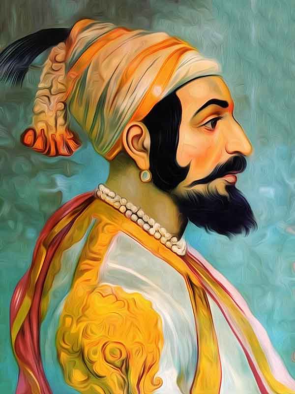
The legend has it that world's most dangerous fortress, as it is known, was constructed in honor of Queen Kalavantin.
Offering stunning views – via rugged terrain with narrow rock-cut steps, steep slopes, and no support whatsoever – the trek to and from the fortress is perilous yet fascinating.
Perched at a height of around 2,250 feet, the Kalavantin Durg is one of the steepest fortresses in the Western Ghats of Maharashtra. Located between Panvel and Matheran, this fort was built during the rule of the Bahmani Sultanate and is guarded purely by nature. A steep set of natural stairs cut into rock provides a challenging climb to even the seasoned trekkers, and we hear the views from the top are nothing short of jaw-dropping!
|
Prabalgad Fort (History)
This fort was built to keep an eye on the ancient ports of Panvel and Kalyan. From the study of the caves in this fort, it is estimated that it belongs to the time of Buddha. The Shilahar and Yadav dynasties made it an army camp because of the strong man-made caves engraved in this fort and named it ‘Muranjan’. It was believed to be built at the time of the Bahamani Empire. Later, it came under the Nizam Shahi dynasty of Ahmednagar. When the Nizam Shahi dynasty was on the verge of collapse, Shahaji Raje came to their support. Still, the Mughal emperors Shahjahan and Adil Shah of Vijapur sent their armies separately to defeat Shahaji. When Shahaji came to know this, he moved his army to fort Kondhana and Murumbdev.
He then requested help against the Mughal and Adilshahi forces from Siddhis of Janjira, but was refused. Shahaji then tried to get help from the Portuguese in the city of Chaul but failed again. Finally, Shahaji, with his wife Jijabai and son young Shivaji moved on to Muranjan fort along with the army. Later in 1636, Shivaji left Muranjan fort. In the same year, the agreement of Mahuli was made according to which the North Konkan went under the Mughal Empire who granted authority to Adilshaha of Vijapur to rule the area in return for tribute. Shivaji grabbed this opportunity. He defeated and captured the Javli area. At the same time, a brave Sardar of Shivaji, Abaji Mahadev won the area of Kalyan, Bhiwandi, and Rayri.
At that time fort Muranjan came under swarajya of Shivaji. Shivaji changed the name of this fort from “Muranjan" to "Prabalgad" (Prabal means "strong"). Later on, in 1665, according to the Treaty of Purandar, Prabalgad was one of the twenty-three forts which were handed over to the Mughal empire. The Mughal Sardar Jaysingh placed a Rajput named Kesarsingh Hada in charge of the fort Prabalgad. In 1658, the Marathas under Shivaji took the fort once again.
The Mughal Sardar Kesar Singh committed suicide after realizing that defeat was imminent. The Rajput ladies in the fort committed Jauhar (self-immolation) to escape dishonor. The mother and son of Kesar Singh who had hidden themselves in the fort were granted freedom by the order of Shivaji. In the investigation of the fort, enormous wealth was found.
Durg sits amid echoing greenery and offers stunning views
‘Durg’ in Marathi translates to the fort. According to local sources, queen Kalavantin built the structure in the 15th century. Kalavantin Durg is alternatively known as the Kelve Teen, Kalavanti, Kalavantinicha Sulka, or Kalawantin. However, it is not a fort in actuality. This Durg is a watchtower that was believed to be used by the rulers to keep an eye on the circumambient region. Kalavantin Durg sits amid echoing greenery and offers arresting views of the encompassing valley. The Durg slants up from the Prabalgad plateau and is in proximity to the Prabalgad Fort.
|
Trek that’s dangerous yet thrilling
A trek up to the Kalavantin Durg is considered to be one of the most challenging yet thrilling treks in the Western Ghats. To reach the summit, one needs to embark on a 3-kilometre hike from Thakurwadi village. Around 2 kilometres away from Thakurwadi, lies the Prabalmachi village. From here, the route bifurcates into two paths. The shorter one leads to the Kalavantin Durg. The longer one goes towards the Prabalgad Fort. The route to Kalavantin Durg involves a 60-degree incline and the rock-cut steps falling on the way are as high as 2 feet.
What to watch out for
1. A near-vertical stairway to the pinnacle
A work of art centuries ago. These steps were hand-cut and sheer physical efforts went on during the 15th century. The giant steps carved out have good space for two people to stand on.
The near-vertical drop can be challenging for the faint-hearted or somebody afraid of heights. Although referred to as Kalavantin Durg, there is no fort. It is a pinnacle that was used by rulers to have a watch around the surrounding area.
2. The Plateau of Prabalmachi
The Prabalmachi Plateau is home to the beauty of both Kalvantin and Prabalgad.
The trail to the left takes you to a triangle-looking Kalavantin while on the right-hand side is the Prabalgad Fort. A vast plateau is a majestic sight when done at the right time.
3. The Climb to Prabalgad
The trek offers the chance of completing two treks and climbing to Prabalgad. The dense forest and the fort has a rich history to soak in.
This is also the place from where you get the coveted or popular photos of Kalavantin with the flight of stairs to the pinnacle.
|
Trail information on the Kalavantin Durg trek
The trail starts from Thakurwadi, a village in the Rajgad district of Maharashtra. To know more about how to reach the base of kalavantin Durg, head over to Plan Your Travel section.
The trek can be divided into three sections:
- The first stretch is the gentle ascent from the Start Point to Prabalmachi Plateau
- The second section is from Prabalmachi to the Col
- The third section would be the final climb from the Col to the pinnacle of Kalavantin
Section I: Start Point of the Trek to Prabalmachi Plateau
Trek Distance: 2.8 kilometers
Trek Duration: 1.5 hours
GPS Coordinates of Start Point of Kalavantin Durg Trek: 18°58’50.16″N 73°12’12.11″E
GPS Coordinates of Prabalmachi Plateau: 18°58’57.85″N 73°12’55.44″E
The trek begins from the parking area at Thakurwadi, the base village. The village is quite big but the start of the trail consists only of a few hutments. A fee of Rs 50 will be collected at the entrance of the trek. This fee is collected for the betterment of the trail and trekking.
The trek through Thakurwadi lasts roughly 10 minutes, sometimes through slushy, muddy roads during the monsoon season and sometimes inside the compound of villagers’ houses.
After this short walk through the village, the trail becomes a gradual ascent up a stone-paved road (used very infrequently for transporting things to Prabalmachi).
There are various shortcuts along the sides of this road that can be explored. You encounter beautiful flora and fauna along this path, including many trees and flowers on shrubs such as karvi, and plenty of birds usually flying around.
As you climb, the view remains constant on one side – mountains, villages, and farms. On the other side, you see the M shaped peak. The trek starts to take a new excitement.
Just after about 30 mins on the trek, on your right, you can see seven to eight waterfalls on adjacent mountains. After heavy rains, you can see as many as 12-14 waterfalls.
About 1.5 hours later, you reach the Prabalmachi plateau. The plateau is larger than a football ground and is covered with yellowish-green grass. There aren’t many trees here. Just the peak to one side and the view of the Panvel district and surrounding mountains to the other.
Section II: Prabalmachi to Col
Trek Distance: 630 meters
Trek Duration: 1 hour
GPS Coordinates of Prabalmachi: 18°58’57.85″N 73°12’55.44″E
GPS Coordinates of Col: 18°58’55.21″N 73°13’13.06″E
From Prabalmachi, there are two routes – one leading to Prabalgad and the other (to the left) leading to Kalavantin. You have a triangle resemblance for Kalavantin while Prabalgad Durg is a flat hill.
The terrain is different from before; it now becomes a muddy, rocky road. The vegetation alongside the trail includes grasslands and moderately tall trees (5-6 ft tall).
On all sides are beautiful views of lush green mountains with multiple waterfalls. Keep to your left on the trails and you will reach the col after an hour of trekking. The trail also becomes a lot uneven. You will have a mix of trekking up and down through this section to reach the Col.
Section III: Col to Pinnacle of Kalavantin
Trek Distance: 150 meters
Trek Duration: 30 minutes
GPS Coordinates of Col: 18°58’55.21″N 73°13’13.06″E
GPS Coordinates of Pinnacle of Kalavantin: 18°58’58.09″N 73°13’11.54″E
The valley sloping away on one side makes you aware of the altitude. A 2-min ascent follows this on rocks before you reach a set of steep narrow steps cut into the rock.
Be extremely cautious here as you could be hurt badly if you fall. Climbing the steps will take about 20-30 minutes. This is followed by a short climb over a rock about 15 ft high to reach the pinnacle.
|Tip: Have the right grip and a good footing for the climb. A good trekking shoe is always good to have instead of sports shoes.
Due to excessive rains, a part of the rock has broken off. This was used to serve as a foothold to climb. This section has become smooth and has become slightly difficult with no footholds or handholds. A rudimentary rope has been fixed by the locals which can be used if you are confident about climbing. But we would not suggest this.
If you are not confident and don’t want to carry your own ropes for a technical climb, just soak in the views after completing 95% of the trek. The view is good from here and pretty much the same from the pinnacle as well.
Safety is very important on a trek. So, if you don’t want to take the hassle of taking a rope or are worried about your safety, stop here. You can still enjoy the views from the base of the Kalavantin.
Pro Tip: Plan your trek in the right season. You might have heard of Everest Jams. The same can be seen during the pre-monsoon or the monsoon season. You have to jostle for space during the crowded season. Go during either the weekdays or the winter season to enjoy the trek more.
The summit is a small oval-shaped area where a saffron flag has been mounted. The panoramic view from here includes Prabalgad, Chanderi, Peb Matheran, Irshalgad, and Ulhas rivers.
The Kalavantin Durg Trek can be done in multiple seasons. Like most treks, the benefits and charm change based on the month that you are trekking.
The peak season for the Kalavantin Durg Trek is the monsoon season. The lush greenery and the views from the peak are stunning during monsoon. This is also one of the reasons why the Kalavantin Durg trek is similar to a crowded trek in Nepal. The monsoon season will see a share of big crowds trekking.
If you go for the trek post-monsoon, the number of trekkers you see is way lesser. You get to see clearer views and the colors change in the Sahyadri.
Pro Tip: If you want to avoid the crowd, go during a weekday in the monsoon season. The other option is to avoid the peak season of May, June. Go on the trek either post monsoon or during the winter months of November, December.
Exploration on the way
There are five caves on the hill. Two of these caves can be explored though there is no marked route. Take the small trail you see during the ascent from Prabalmachi to the V-shaped junction.
The first of the caves is about 15 mins off the main trail and very easy to find. The first cave is simply a 25-m tunnel leading to an 8” by 6” box structure of 4 ft height.
The second cave is much farther and takes you close to Prabalgad Fort. It is not advisable to try to reach the second cave, as the trail is unmarked and rarely taken by trekkers.
Two other caves can be spotted from the trail if you look carefully at the summit. The fifth cave is on the opposite side of the trail and is explored by rappelling down from the summit (under trained guidance).
For more information related to permission, water sources, and other finer details about the trek, go to the FAQs section.
Mobile users: Click on ‘Complete trek guide’ at the bottom of the page to access the rest of the Kalavantin Durg Trek Guide.
The Kalavantin Durg trek is classified as a moderate-grade trek. From Thakurwadi at 52 feet, you will gain approximately 1708 feet in altitude.
Here’s a guide to help you get fit for a Moderate grade trek in 4 weeks.
Cardiovascular endurance
In case you’re just starting with a fitness routine, start slow and increase your pace every day in the following manner
Target completing a brisk walk of 5 km in 45 minutes when you begin.
Gradually increase your pace by walking 5 km, 4 times a week.
As you become more comfortable, introduce jogging in your routine.
Progressively increase the distance you jog in a workout until you can complete 5 km in 37 mins.
If you prefer cycling over running, target covering 15 km in 60 minutes when you begin.
Progressively increase your pace to cover 20 km in one hour.
Strength training
This is an important area you need to work on.
Strength training is equally important to trek comfortably. Work on your glutes, calves, and knees. Additionally, work on strengthening your core.
You must strengthen your core muscles. For strengthening your core muscles, holding a plank and its variations (elbow, side planks) are the best exercises to go about doing it.
Also, try these exercises for strength-
Target 4 sets of squats with 20 in each set
– Squats (Mix it up with sumo squats)
– Lunges (Forward, backward and lateral lunges)
– Planks
Flexibility
Flexibility determines the amount of movement your bones can make in any direction around joints such as shoulders, elbows, hips, and knees.
It is an aspect that will help you trek comfortably. Carrying a backpack, however, light can become a strain. Stretching your hamstrings, quadriceps, hip flexors, and lower back muscles regularly, promotes relaxation in the tissues reducing the strain on your back.
If you can’t go out and jog because of time and space constraints, here’s a video you can use to work out indoors.
What to pack for the Trek
When attempting it as a standalone trek in Summer & Winter
- Basic First Aid kit*
- Identity Card
- Trail/ region map
- Cap/ Scarf/ Bandana & Sunglasses
- Water (Minimum two liters)
- Lemon and salt OR Electrolyte Powder/Drink (Electral/Gatorade/Glucon D, etc.)
- High-calorie snacks (Nuts & dry fruits, a home-baked cake, etc.)
- Insect repellent (Odomos, etc.)
- Spare newspaper
- Multi-Tool/ Swiss Army Knife
- Torch/ Headlamp with spare batteries.
- Powerbank
- Safety Pins, Rubber bands & Whistle (Useful in emergencies.)
- Optional: Rope, Camera.
During Monsoon
- Quick Dry T-shirts are preferable over cotton tees.
- Poncho
- An additional set of clothes, socks, etc.
- Plastic sheet to wrap electronic devices.
If you are attempting Kalavantin as part of a longer multi-day trek, you should carry
- Sunscreen (SPF 50+)
- Rehydration pouch/ bladder
- Tent & Sleeping Bag/ Mat
- Trekking pole
- A spare set of clothes & footwear (Floaters, sandals, etc.)
- Water filter/ Thin cotton cloth & water purification tablet.
- Utensils
- Antiperspirant powder (Candid, etc.)
- Magnesium Flint/Matchboxes
- Basic Toiletries: Toothbrush & Toothpaste/Mouthwash.
*First aid kit
- Scissor
- Band-aids (Regular & Waterproof)
- Analgesic spray (Relispray, Volini, etc.)
- Antiseptic Liquid (Savlon, Dettol etc.)
- Antiseptic powder (Povidone-Iodine-based powders like Cipladine, Savlon, etc.)
- Cotton roll & Bandage
- Crepe Bandage
- 1-inch wide medical tape (paper or cloth.)
- Micropore tape
- Tablet for motion sickness (Avomine), Acidity (Gelusil, Digene, etc.).
- Mild pain relief tablet (Crocin)
Note: Always consult a doctor before taking any medicine.
References:
 Support Us
Satyagraha was born from the heart of our land, with an undying aim to unveil the true essence of Bharat. It seeks to illuminate the hidden tales of our valiant freedom fighters and the rich chronicles that haven't yet sung their complete melody in the mainstream.
While platforms like NDTV and 'The Wire' effortlessly garner funds under the banner of safeguarding democracy, we at Satyagraha walk a different path. Our strength and resonance come from you. In this journey to weave a stronger Bharat, every little contribution amplifies our voice. Let's come together, contribute as you can, and champion the true spirit of our nation.
 |  |  |
| ICICI Bank of Satyaagrah | Razorpay Bank of Satyaagrah | PayPal Bank of Satyaagrah - For International Payments |
If all above doesn't work, then try the LINK below:
DISCLAIMER: The author is solely responsible for the views expressed in this article. The author carries the responsibility for citing and/or licensing of images utilized within the text. The website also frequently uses non-commercial images for representational purposes only in line with the article. We are not responsible for the authenticity of such images. If some images have a copyright issue, we request the person/entity to contact us at This email address is being protected from spambots. You need JavaScript enabled to view it. and we will take the necessary actions to resolve the issue.


